


Nouveau guidetour des sept laux rando course

trailer38
User
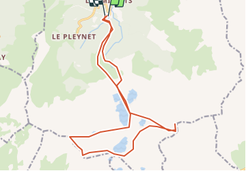

Length
20 km

Max alt
2878 m

Uphill gradient
2438 m
Km-Effort
53 km

Min alt
1092 m

Downhill gradient
2416 m
Boucle
Yes
Creation date :
2014-12-10 00:00:00.0
Updated on :
2014-12-10 00:00:00.0
--
Difficulty : Very difficult

FREE GPS app for hiking
 SityTrail
IGN / Geographical institutes
SityTrail Plus
The world is yours!
About
Trail Running of 20 km to be discovered at Auvergne-Rhône-Alpes, Isère, Le Haut-Bréda. This trail is proposed by trailer38.
Description
tour des sept laux rando course
Positioning
Country:
France
Region :
Auvergne-Rhône-Alpes
Department/Province :
Isère
Municipality :
Le Haut-Bréda
Location:
La Ferrière
Start:(Dec)
Start:(UTM)
270443 ; 5018181 (32T) N.
Comments